Northern Areas Of Pakistan
ADVENTURE CENTER PAKISTAN (ACP)
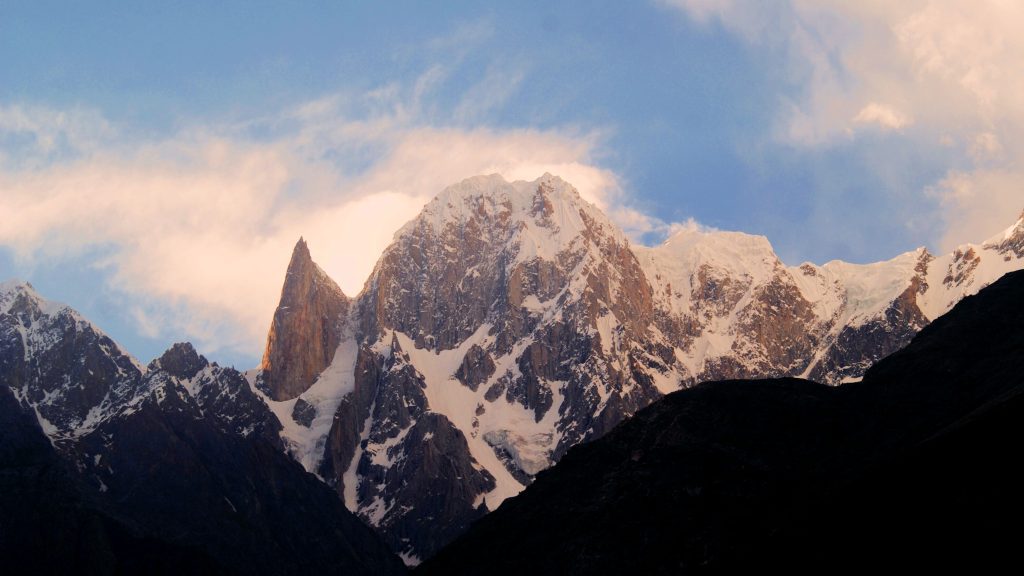
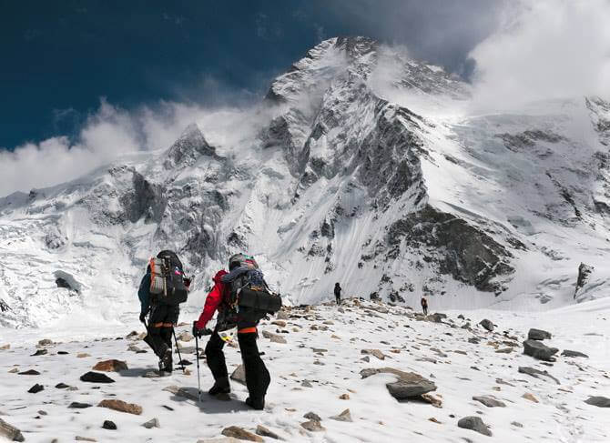
The Northern Areas are situated at the intersection of four of the world’s mightiest mountain ranges Hindukush, Himalaya, Karakorum, and Pamirs (Roof of the World). These ranges form the largest concentration of high mountain peaks in the world within a radius of fewer than 100 miles; as many as 100 elevations range from 18,000 feet to the world’s second-highest peak Godwin Austin (K-2) at 8611 meters. There are 19 peaks higher than 7,600 meters from the sea level. More than 60 peaks have been discovered in the Karakorum alone. Some of the famous peaks of the Northern areas include the world’s most dangerous peak-Nanga Parbat (26,660 Ft.), Trango Tower, Gasherbrum 1 and 11, Diran Peak, Uli Biaho, Snow Lake, and Sputnik Peak. These peaks and other mountains make the area a paradise for trekkers and mountaineers.
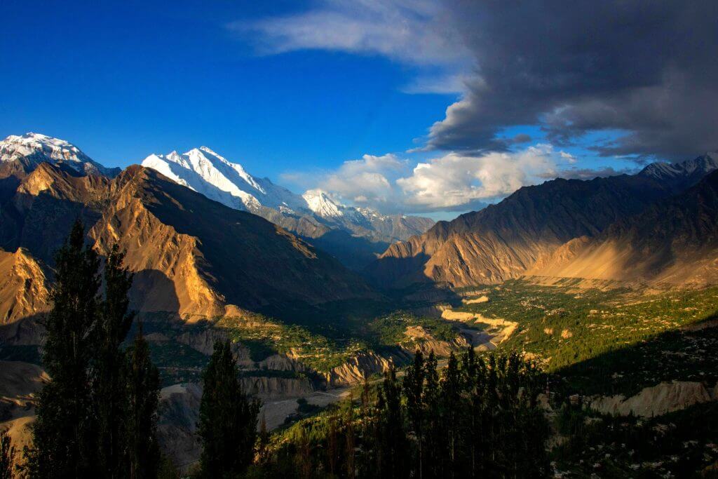
These mountain ranges have naturally divided the area into the beautiful and picturesque valleys of Gilgit, Daril/Tangir, Chilas, Astore, Hunza, Skardu, Ishkoman-Gupis, Yasin, Shigar, Khapulu, Skardu, Ronda, and Kharmang. These valleys are further bifurcated into smaller valleys with breathtaking scenic views. The area’s climate can generally be described as extreme, i.e., warm and dry in summers while severe cold in winters. But at the same time, there is a tremendous ecological and climatical variation from valley to valley, depending upon elevation from sea level. The weather remains warm in the low-lying valleys during summer, while valleys at higher elevations have pleasant summers. Similarly, the winter season at higher altitudes is frigid than in the low-lying valleys.
In the relatively plain areas, mean minimum and maximum temperatures during summer have been recorded as 37 and 22 degrees centigrade, respectively. At the same time, mean maximum and minimum temperatures for winter have been recorded as12 and minus 1-degree centigrade, respectively. In the high lands, the mean maximum temperature in winter remains around the freezing point, with minimum temperatures falling as low as -10 degrees centigrade. The area is situated on the opposite leeward side of the summer monsoon, resulting in meager precipitation, which hardly exceeds 5 to 6 inches annually. At higher altitudes, it falls snow. consequently, the mountains are generally arid and sans vegetation.
Gilgit-Baltistan
Guide
HOW TO REACH THE AREA
- The Towns of Gilgit and Skardu are linked by air with Islamabad, the capital of Pakistan. PIA runs daily, albeit subject to weather flights to Gilgit and Skardu. The one-hour flight from Gilgit or Skardu is the most thrilling and spectacular experience, which provides a panoramic view of a sea of snow-clad mountains with enchanting scenic beauty. It is an unforgettable event. Flying over the astonishing lack of Saif-ul-Malook when the plane enters the valley, it looks as if its wings are about to touch the cliffs of mountains, particularly near Killer Mountain, Nanga Parbat, and the towering K-2. Amidst awe-inspiring moments and unforgettable experiences, one reaches Gilgit or Skardu.
- Another way to reach the area is through the famous Karakorum Highway (KKH) completed in 1978 by the Pakistan Army Engineers with the help of Chinese technicians and experts. The road itself is a monument of human ingenuity, and civil engineering skill carved out of sheer mountains and rocks at a high cost of precious human life. The KKH starts from Havelian, about 100 kilometers from Islamabad, zigzagging through Abbottabad, Mansehra, Thakot, Basham, Pattan, Kamila, Sazin, Chilas, Gilgit, Hunza, and then goes to Khunjerab Pass (4602 meters above sea level) at the Pakistan China border. It connects Pakistan with the Sinkiang Province of China.
- From Gilgit, one can take another branch of KKH to Skardu from Alam Bridge, which is 227 kilometers long. The total length of KKH from Havelian to Khunjerab is 753 kilometers. Traveling on KKH itself is an awe-inspiring moment as one drives between the mighty Indus and high mountain ranges. During the journey, one can satisfy their anthropological urges by reading the rock carvings, which date back to the Buddhist era.
Once you reach Gilgit, you will be amazed and spellbound by seeing nature at its best. The Adventure Center Pakistan will be a launching pad for your tours to the other valleys.
GILGIT AND HUNZA:
Gilgit town is situated on the bank of the Gilgit River. Its strategic location has played a vital role in the history of the sub-continent. In the words of John Keay, Gilgit “is the hub, the crow’s nest and the fulcrum of Asia.” At present, it serves as a headquarters for the Gilgit Baltistan administration. The town’s main attraction includes Buddha’s statue at Basin, Karga Stream, with its trout fishing, the Memorial of the war of freedom at Chinar Bagh, and a Chinese memorial at Danyore. There are two Polo grounds in the town where one can enjoy the traditional game of Gilgit-Baltistan, i.e., polo is being played in its unsophisticated and undiluted form. Traditional souvenirs, antiques, and Chinese goods like pottery and silk are sold like hot cakes in the local bazaar.
Hunza is situated in the north of Gilgit at 110 km. Along KKH. The capital of the former Hunza state, Karimabad, is worth visiting. It has tremendous views of peaks and glaciers, including Rakaposhi (7788m) and Ultra (7388m). Karimabad is now the center for all touristic attractions, including comfortable hotels. From here, one can visit other sightseeing places, a full-day excursion to Khunjrab pass (16400”) on KKH, the border valley of Pakistan with China, or a half-day tour to hopper glacier in Nagar by jeep. Baltit and Altit forts can be visited on a short hike from Karimabad, which are believed to be 500 and 900 years old.
SKARDU:
Likewise, the town of Skardu serves as a base camp for visiting other valleys with scenic charms and peculiar traditions and cultures of Baltistan, known as the little Tibet in history. It is now the seat of the district administration of Skardu. It is surrounded by high mountains and is perched at the bank of the mighty Indus. It lies at an altitude of 7,500 feet above sea level; as such, it has got pleasant summer. It is linked with Gilgit by Karakorum Highway and road access to other valleys like Khapulu, Shigar, Ronda, and Charming. There are many sightseeing places in and around Skardu. The main attractions are Shigar valley, Khapulu, and Satpara lake, ideal locations for fishing and picnicking. Moreover, the Deosai plateau (4,000 meters high) and Rundu valley, with their unhampered natural beauty, are worth seeing spots in Baltistan.